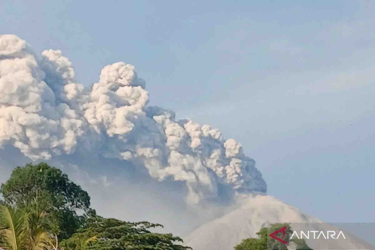
“Mapping out cold lava flood-prone areas is essential to minimize the negative impacts such floods might cause,” head of the BNPB’s Data, Information, and Communication Center, Abdul Muhari, said in Jakarta on Wednesday.
He added that the mapping of vulnerable areas involves land sweeping using drones, with the help of a contour map and the results of an analysis of the volcano provided by the Geology Agency of the Energy and Mineral Resources Ministry.
The official noted that the analysis shows that lengthy and heavy rain at the peak of the newly erupted volcano may lead to cold lava floods in at least three villages in East Flores district, namely Dulipali, Padang Pasir, and Nobo.
Muhari further informed that officers stationed at the Geology Agency’s volcano observation post in Walanggitang sub-district have detected the accumulation of lava materials in the northeast of the mountain, noting that the materials are flowing at a very low speed.
The mapping of the vulnerable zones is similar to the one carried out by a team from the BNPB’s Directorate of Mapping and Disaster Risk Evaluations at Mount Marapi in West Sumatra, he added.
He noted that in early May 2024, torrential rain carried at least one thousand cubic meters of volcanic material sediment from Mount Marapi’s crater to residential areas, causing fatalities and considerable destruction in five regions, including Tanah Datar district.
Taking note of this, he informed, the BNPB has installed early warning sirens and sensors to alert residents to evacuate in the event of an increase in the water level in rivers around the volcano.
“Learning from experience, we cannot afford to let such a calamity befall East Flores,” he added.
Related news: Potential for Mt. Lewotobi to erupt again: Geological Agency
Related news: Airport authorities urged to monitor Mt. Lewotobi’s volcanic ash
Related news: Komodo Airport reopens after Mount Lewotobi eruption test clears
Translator: M. Riezko, Tegar Nurfitra
Editor: Azis Kurmala
Copyright © ANTARA 2024


Leave a Reply